The plans below show the changes in the particular area from 1965 to the present day, and the plans also give a description of the proposed changes in the future. Summarize information by selecting and reporting the main features, and make comparisons where relevant.
The two provided images depict a city’s layout in 1965 and 2015, as well as some planned changes for 2018. It is evident that the riverfront area has undergone significant development in the allotted time, and this development is anticipated to continue in the years to come.
Altogether, the region has experienced significant growth in the last fifty years, and additional modifications are planned for the future.
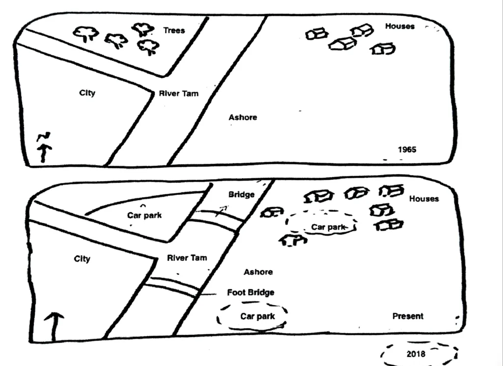
A branch of the Tam River flowed from the west to the east in 1965, and the main river flowed from north to south. There were some trees to the northwest and a city to the southwest between this branch and the main river. The northeast had a few houses, while the southeast was completely deserted.
The trees on the northwest have now been replaced by a parking lot, and the northeast now has more homes than before. In the direction of the tributary’s north, a footbridge has been constructed, and there is one footbridge on the river. In 2018, plans called for the construction of two parking lots: one in the middle of the houses and another to the southeast of the river.