Compare the town of Brindell and local areas in 1800, 1900, and 2000. Summarize the information by selecting and reporting the main features, and make comparisons where relevant.
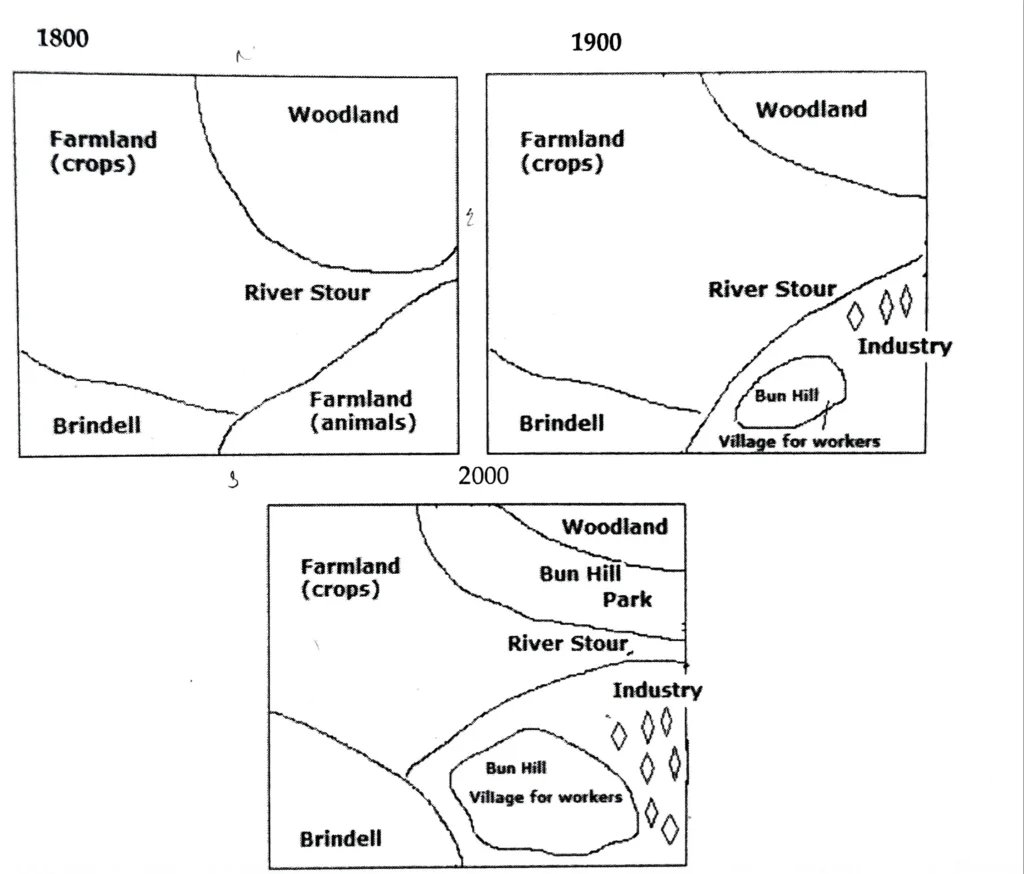
The three maps depict the significant changes that Brindell and the surrounding areas experienced between 1800 and 2000, a span of two centuries. Altogether, Brindell changed from being a town centered on agriculture to a region with a variety of uses.
River Street, which is visible in the layout’s center, served as a major barrier dividing the entire district. Brindell was located near the river’s southwest end. Near Brindell, there were two agricultural zones: one to the east was used for animal grazing, and the other to grow crops. There was a forest area at the northeast end of the river.
By 1990, considerable changes could be seen in the district. The whole grazing area was substituted with Bun Hill and Industries, which is noticeable. An industrial zone took the place of the upper portion of the grazing area. The lower portion was developed into the worker village known as Bun Hill.
Many more alterations were noted in 2000. Brindell grew until he was nearly twice as big. The creation of Bun Hill Park resulted in a reduction of cropland. Bun Hill expanded, and numerous new industries opened up to the east of the village.